Smart Buoy Networks: Listening to Our Ocean Like Never Before in 2026
The maintenance winch jammed halfway through the recovery cycle, leaving a 2.4-meter spar buoy dangling at a fifteen-degree angle off the stern rail. According to the shore-based telemetry portal, the platform was operating within nominal parameters. Solar charging was stable. Satellite handshake intervals were green. All twenty-two sensor channels were publishing clean, time-stamped packets every fifteen minutes.
The reality was different. Barnacles had colonized the ADCP transducer face enough to narrow the acoustic beam by nearly eight degrees. The mooring bridle had chafed through its outer sheath, letting seawater wick up into the junction box. Inside, condensation was bridging two unshielded ground traces, causing the controller to silently reboot every forty minutes. The software didn’t flag a failure. It just filled the micro-outages with interpolated baseline values. To the dispatch screen three hundred miles inland, the buoy looked perfectly healthy. On the maintenance deck, it was a slow-burning liability.
That disconnect is where most smart buoy deployments either prove their value or quietly bleed budget. The phrase “listening to our ocean” gets used in grant proposals and vendor brochures, but oceans don’t broadcast cleanly. They scatter, they drown signals in wind noise, they coat hardware in organic growth, and they demand mechanical compromises that lab validation never captures. The technology exists. The data pipelines are functional. The friction lives in the space between the deployment diagram and whatever happens once a mooring line meets a winter storm.
Hardware Behavior When Salt and Swell Enter the Equation
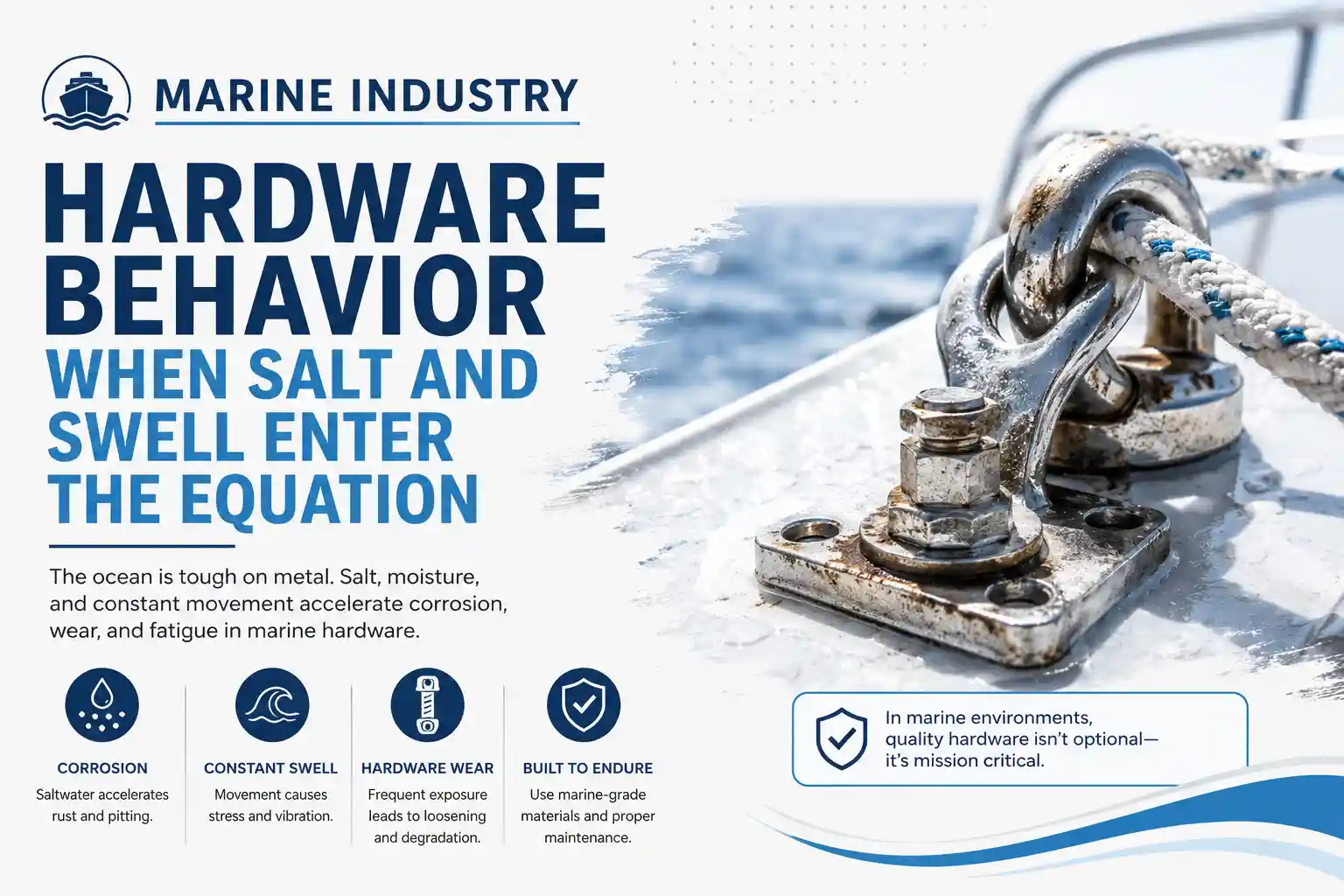
Marine instrument manufacturers publish ingress protection ratings, pressure tolerances, and expected battery lifespans under controlled thermal cycling. Those numbers assume static mounting, clean freshwater rinsing between service intervals, and predictable solar irradiance. Open-water arrays don’t get those conditions. They get hammered by wave slamming, exposed to UV degradation that cracks silicone potting over eighteen months, and subjected to constant pitch-and-roll that shifts internal liquid-level sensors out of alignment.
I’ve serviced arrays where the hardware survived, but the calibration didn’t. A dissolved oxygen probe mounted three meters below the waterline will read accurately in a test tank. Drop it into a tidal channel with suspended sediment and variable current velocities, and the diffusion membrane fouls within weeks. The output doesn’t flatline. It drifts. Slowly. Enough that a coastal monitoring team won’t notice the degradation until quarterly lab samples suddenly diverge from the telemetry baseline by two milligrams per liter. The dashboard shows a smooth trendline. The water tells a different story.
Connectivity architecture compounds the problem. Most commercial smart buoys rely on dual-path satellite comms—typically Iridium short-burst data paired with a terrestrial LTE backup for nearshore units. That works until atmospheric ducting traps signals below the horizon, or until heavy precipitation attenuates the Ku-band uplink during a squall line. The modem doesn’t fail. It just buffers. When the connection clears, the controller dumps forty-eight hours of queued packets in a rapid burst. The shore-side ingestion pipeline, designed for steady fifteen-minute intervals, chokes on the sudden volume. Data gets dropped. Timestamps overlap. The dashboard smooths the gap and moves on.
Installation constraints are rarely discussed during procurement. You can’t route telemetry cables through the same conduit as the mooring load cell without introducing electromagnetic crosstalk that corrupts tension readings. You can’t place the solar array directly above the primary telemetry mast without shadowing the GPS patch antenna, which degrades positional accuracy enough to skew current vector calculations. Every placement choice is a compromise between ideal sensor geometry and the physical reality of a bobbing steel platform.
Crews adapt, but not in ways that align with the installation manual. I’ve watched technicians secure junction boxes with marine-grade tape and stainless steel hose clamps because the factory vibration-dampening mounts cracked after six months of continuous heave. I’ve seen operators reroute acoustic transducer cables away from the radar scanner’s sweep arc to prevent RF interference, accepting a slightly weaker signal return in exchange for clean navigation displays. These aren’t deviations from procedure. They’re field modifications born from watching equipment degrade in real time.
Testing the Array When Conditions Stop Cooperating
I ran a localized validation sequence on a mid-Atlantic coastal array, intentionally throttling the satellite uplink and introducing simulated latency to mimic offshore constellation handovers. The goal wasn’t to stress-test the hardware. It was to observe how quickly stale environmental data becomes operationally misleading when the remote interface tries to mask the gaps.
Within six minutes of simulated comms loss, the ingestion software began interpolating sea surface temperature readings based on the last received value. The actual water column was cooling rapidly as a cold front pushed through, but the dashboard held the baseline steady. A fisheries management analyst reviewing the data assumed stable thermal stratification and adjusted quota recommendations accordingly. The model was wrong. The ocean wasn’t.
The discrepancy didn’t come from a faulty sensor. It came from software assuming continuity when the environment was actively shifting. Predictive smoothing works well in stable, low-energy zones. It struggles when wind-driven mixing and tidal flushing alter vertical profiles faster than the uplink can report. The algorithm isn’t designed to account for that. It just fills blanks.
Dashboard friction compounds during multi-station deployments. When forty buoys publish simultaneously, alert fatigue becomes a real operational hazard. You scroll past minor voltage fluctuations, temporary GPS lock losses, and routine self-calibration cycles to find the one parameter that actually indicates a compromised mooring. The interface doesn’t fail. It just demands more cognitive bandwidth than a single watchkeeper can spare during active monitoring shifts.
I’ve noticed that the most functional deployments don’t push every available metric to the primary screen. They filter aggressively. They suppress routine noise. They prioritize deviations that exceed historical baselines by more than two standard deviations. The rest sits in raw logs for later forensic review. It’s a less polished approach, but it prevents operators from missing a genuine structural shift because they’re drowning in low-priority notifications.
The setup friction is equally underestimated. Calibrating a multi-sensor array on a moving deck requires three people, a stable weather window, and a working understanding of how tidal harmonics affect reference elevations. You can’t just lower the unit and walk away. You need to verify GPS antenna clearance, check torque specifications on the bridle shackles, confirm telemetry handshake protocols, and record baseline sensor values against portable reference instruments. Rush any of it, and you introduce systematic errors that don’t surface for months.
Who Actually Extracts Value, and Who Pays for the Upkeep
Operators who make these networks pay for themselves aren’t reading marketing materials. They’re the port authorities that use real-time current velocity data to adjust tugboat scheduling, the coastal engineering firms that correlate wave height telemetry with breakwater fatigue cycles, and the hydrographic offices that validate charted depth corrections against live tidal observations. They understand that a smart buoy isn’t an autonomous data factory. It’s an auxiliary input layer that requires constant cross-validation against physical reality.
Crew members and regional agencies rarely treat these dashboards as primary decision tools unless the alert thresholds match actual operational ranges. If a warning triggers every time salinity fluctuates within normal estuarine mixing bands, it gets muted. Permanently. Deployment resistance rarely comes from stubborn technicians. It comes from systems that demand more screen time than the watch schedule allows, and more diagnostic follow-up than the maintenance budget supports.
Training isn’t a two-day vendor seminar. It’s six to nine months of adjusting filter coefficients, watching what actually drifts under load, and accepting that half the anomaly flags are artifacts from platform motion, not sensor failure. The learning curve isn’t steep, but it’s long. You need operators who understand the difference between a genuine environmental shift and a calibration artifact caused by a tilted accelerometer. You need data managers who know how to trace a corrupted packet back to a fatigued coaxial connector or a misconfigured serial multiplexer.
Infrastructure requirements scale non-linearly. Low-earth orbit satellite terminals require unobstructed sky visibility and stable antenna alignment. Older terrestrial gateways on remote coastlines prioritize emergency traffic over telemetry packets, starving the dashboard during bandwidth contention. Cellular nodes work beautifully within eight nautical miles of shore, then drop entirely past headland interference. Hybrid comms architectures solve the coverage problem, but they add configuration complexity, additional failure points, and a heavier maintenance burden for field staff who already struggle to schedule retrieval vessels around commercial shipping lanes.
The cost-to-practicality ratio rarely breaks even on data volume alone. The real return comes from earlier detection of gradual equipment wear, better storm-surge modeling, and reduced reliance on manual CTD casts that require dedicated survey vessels. But those benefits only materialize when the array is integrated into existing monitoring workflows, not layered on top of them as an afterthought. You need maintenance schedules, calibration protocols, and contingency plans before you deploy. Otherwise, you’re just buying a floating liability.
Coastal Mesh Arrays vs. Deep-Water Single Points
Coastal deployments compress the error margin. You’re within cellular or line-of-sight VHF range most of the day. Cellular towers bounce off headlands, and satellite uplinks arrive with minimal latency. The telemetry system mostly sits idle, logging wave period, surface temperature, and tidal elevation. Software behaves predictably. Hardware stays relatively dry behind enclosed housings. Maintenance cycles align with port call schedules and calm tidal windows.
Push past the continental shelf or into open-ocean deployment zones, and the entire monitoring paradigm shifts. Satellite latency stretches to ninety-second intervals during constellation handovers. Wind and swell mask acoustic transducer readings. Pitch and roll introduce measurement noise that requires aggressive filtering. Older navigation buoys on legacy moorings run on low-frequency radio telemetry that chokes when you try to push high-frequency acoustic Doppler profiles through limited bandwidth.
Automated monitoring works well when the environment behaves predictably. Manual oversight becomes the backup plan when it doesn’t. I’ve seen hybrid setups where coastal engineers keep a physical tide gauge logbook during heavy weather because the automated trendline smoothed out the spike caused by wind-driven setup. The system didn’t malfunction. It just averaged the data in a way that erased the operational reality.
Commercial oceanographic arrays handle this better than consumer-grade marine weather stations, but only marginally. Commercial terminals include better error correction, redundant power inputs, and wider operating temperature ranges. They still struggle with antenna misalignment during heavy rolling, and they still suffer from firmware updates that occasionally break legacy NMEA 0183 parsers. The difference is that professional deployment teams know how to roll back a patch while the support vessel is at anchor. Amateur operators usually don’t.
Older infrastructure compounds these limitations. Moorings built before the widespread adoption of integrated telemetry rarely have dedicated routing channels for secondary sensors. You tap into existing power lines, splice into legacy analog outputs, and hope the signal isolation holds. It usually does, until thermal expansion shifts a ground plane and introduces voltage drift. You don’t find the problem until the port hydrography data doesn’t match the buoy log. By then, you’ve been operating on skewed readings for months.
Why the Baseline Shifts When the Platform Moves
Marine operational logic doesn’t translate cleanly into static data pipelines. A buoy isn’t a fixed survey point. It’s a dynamic mass responding to hydrodynamics, wave-induced heave, tidal currents, and organic growth. When a smart array reports a sudden drop in subsurface oxygen concentration, the algorithm looks for a dead-zone expansion. The oceanographer knows the probe was temporarily pulled into a low-oxygen wake from a passing vessel. The software lacks context. It reports what it measures, not what it understands.
Infrastructure limitations amplify the problem. Satellite constellations promise near-constant coverage, but antenna alignment on rolling decks introduces signal dropouts that aren’t logged as outages. They register as data gaps. The remote interface fills them with interpolated lines. The water column was actually stratifying under a sudden thermal inversion. The dashboard draws a flat profile.
Hardware degradation is rarely catastrophic. It’s cumulative. A corroded ground plane, a fatigued coaxial connector, a fouled turbidity lens, a stretched tension cable on a wave height accelerometer. Each one degrades the signal-to-noise ratio just enough that the remote interface starts averaging instead of reflecting. Operators adapt by layering redundancy, but redundancy adds weight, cost, and another set of maintenance intervals that compress during heavy weather operations.
Communication reliability fluctuates with atmospheric conditions. Solar activity disrupts ionospheric propagation. Heavy precipitation attenuates satellite signals. High sea states scatter antenna lobes. The telemetry system doesn’t fail during these conditions. It just operates at reduced fidelity, reporting what it can capture while the rest sits buffered until the next uplink window.
Human workflow adaptation is the only thing that bridges the gap. Field teams learn to read the dashboard skeptically. They verify critical alerts with manual sampling. They ignore routine fluctuations that fall within established noise bands. They log discrepancies by hand when the software smooths out reality. It’s inefficient on paper. It’s necessary in practice.
Recent maritime engineering research from coastal labs aligns with these observations. Deployment studies consistently note that automated anomaly detection works best when calibrated to specific bathymetry, tidal regimes, and mooring geometries. Generic thresholds generate false positives at an unsustainable rate. The ocean introduces noise that tank validation rarely captures. NOAA buoy data quality control manuals and university marine lab studies on sensor drift in high-energy zones confirm how environmental variables distort readings when telemetry gates don’t filter for wave-induced pitch and roll. IMO navigation safety notes on electronic observational data validation repeatedly emphasize that automated systems require human cross-checking before influencing routing or coastal engineering decisions.
Documented Friction Points That Don’t Make It Into Procurement Docs
The friction accumulates in the rigging and on the screen. It’s rarely dramatic. It’s persistent.
Salt creep along unsealed DIN rail connections causes phantom voltage readings that trigger low-power warnings. Cable runs routed near solar charge controllers soften under UV exposure, requiring replacement during scheduled maintenance windows. Dashboard clutter becomes a real issue when every subsystem publishes to the same remote interface. You’re scrolling past wave period, surface salinity, and dissolved oxygen levels to find the one parameter that actually matters during a squall warning.
Software pushes arrive during low-wind periods, but firmware patches occasionally reset calibration coefficients, forcing the data manager to manually restore baselines while the vessel is en route to a maintenance site. Sensor degradation on turbidity probes shows up as a gradual measurement drift that only gets caught during manual cross-sampling. The learning curve isn’t steep, but it’s long. Operators spend more time troubleshooting false alerts than they do responding to actual environmental shifts.
Corrosion doesn’t wait for warranty periods to expire. It exploits every unsealed interface, every poorly routed cable tie, every mounting bracket that vibrates against painted steel. Maintenance burden scales non-linearly once you exceed the manufacturer’s recommended service interval. Inconsistent tracking emerges when satellite handovers collide with heavy swell masking antenna patterns. Weather interference isn’t an exception. It’s the baseline.
Unreliable updates compound dashboard frustration. When the system refreshes every fifteen minutes during cellular coverage, then drops to forty-minute intervals offshore, the remote interface starts displaying stale current vectors that conflict with physical tide tables. Operators adapt by trusting local hydrographic references over remote portals. It’s a rational compromise, but it undermines the original purpose of the deployment.
Installation delays rarely stem from missing components. They come from vessel scheduling constraints, existing mooring congestion, and the reality that retrieving a working buoy means interrupting normal monitoring operations for days while technicians route cables, test signal isolation, and recalibrate sensor baselines against portable reference instruments. You can’t just lower it and walk away. You have to integrate it into an ecosystem that’s already running at capacity, then accept that twenty percent of the initial data will be garbage until the unit settles onto its mooring.
The Practical Compromise After the Hype Fades
Integrated buoy arrays work when they’re treated as an auxiliary observation layer, not an autonomous truth source. Operators who survive deployment friction don’t chase perfect data streams. They build tolerance for latency, cross-reference dashboard flags with manual sampling, and accept that some parameters will drift until maintenance can catch them. The systems are useful. They’re just not infallible.
You still need someone on the deck who knows the difference between a sensor glitch and a real hydrographic shift. Someone willing to wipe salt off a terminal screen, trace a corrupted data packet back to a loose ground lug, and understand that open-water conditions rarely match the calibration spreadsheet. You need coastal managers who recognize that remote monitoring reduces guesswork, but doesn’t eliminate the need for experienced field judgment.
The technology doesn’t replace hydrography. It extends it. It gives you more data points to work with, but it also gives you more ways to misinterpret what you’re seeing if you don’t understand the environment it’s measuring. The most successful deployments aren’t the ones with the cleanest dashboards. They’re the ones where field teams know exactly what the system can’t see, and they compensate accordingly.
When the winch finally released and the buoy cleared the water, the maintenance lead didn’t check the telemetry portal first. They checked the bridle, the transducer face, and the junction box seals. They logged the physical condition, noted the fouling patterns, and recalibrated the dissolved oxygen probe against a handheld reference meter before lowering it back into the water. The dashboard would go green again within twenty minutes. That wasn’t the point. The point was knowing exactly which part of the data you could trust, and which part you needed to verify with your own eyes.
Howard Craven writes about offshore telemetry systems, hydrographic operations, and marine infrastructure workflows, with a focus on how environmental conditions affect real-world deployment reliability.