Marine IoT, When the Telemetry Feed Stops Matching the Bridge: Field Observations on Connected Vessel Systems
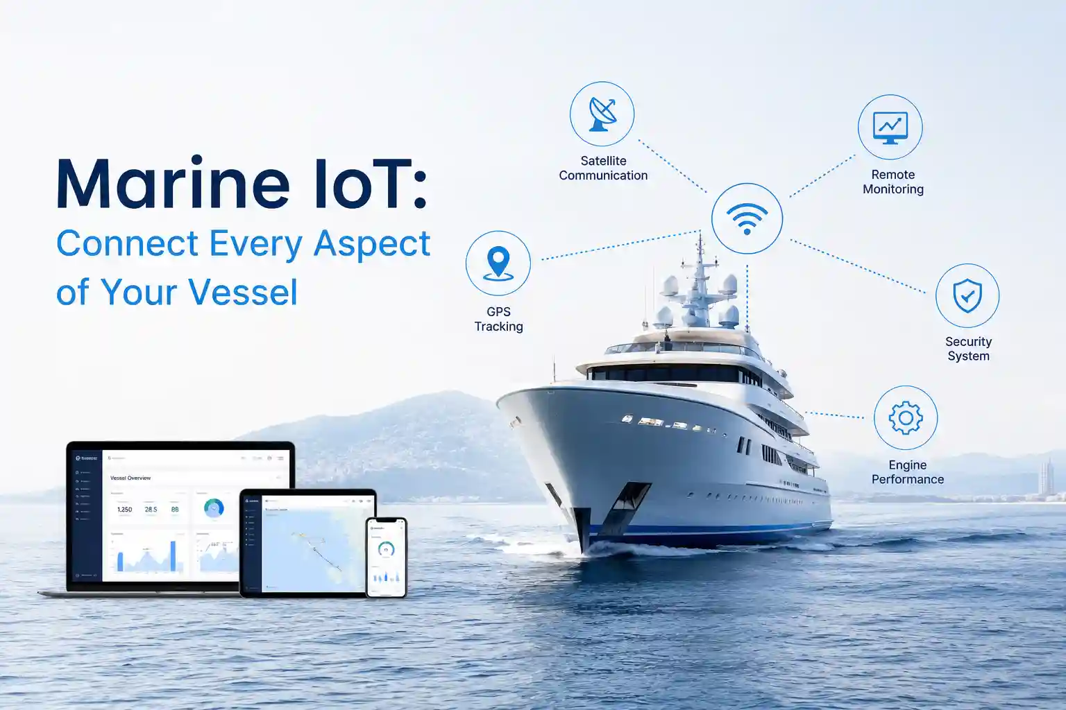
The retrofit package arrived in a reinforced crate labeled Marine IoT: Connect Every Aspect of Your Vessel. The brochure showed clean routing diagrams, wireless sensor nodes snapping into place, and a unified dashboard displaying real-time fuel curves, hull stress metrics, and propulsion efficiency. On the quay, under a steady drizzle, it took four hours to trace why the gateway couldn’t handshake with the legacy NMEA multiplexer already bolted to the engine room bulkhead. By hour six, the chief engineer had bypassed two wireless temperature probes and hardwired them directly to the local alarm panel because the battery-backed transmitters kept dropping off the mesh during high-vibration generator cycles. The dashboard eventually lit up. It just didn’t tell the whole story.
That disconnect isn’t unusual. It’s the baseline condition when digital architecture meets actual maritime operations. The promise of vessel-wide telemetry is straightforward: pull data from machinery, navigation, environmental sensors, and cargo systems, route it through a central processing node, and stream it ashore for optimization. The execution runs into thermal gradients, salt crystallization, electromagnetic interference from thruster drives, and the reality that a working vessel rarely has spare conduit runs or idle watch hours for installation. The hardware behaves as specified in lab conditions. Out at sea, it degrades, it adapts, and it requires constant human calibration.
This isn’t a critique of the concept. It’s an accounting of what happens after the cables are run and the firmware flashes. The friction doesn’t live in procurement documents. It lives in fatigued cable glands, delayed satellite handovers, false alert thresholds, and the quiet compromises operators make when the remote interface starts smoothing over reality instead of reflecting it.

Hardware Behavior Under Continuous Exposure
Manufacturers publish ingress protection ratings and MIL-STD vibration tolerances. Those numbers hold up in controlled testing. On a working deck, they meet continuous salt spray, thermal cycling between engine room heat and night-shift cooling, and the specific resonance frequency of a medium-speed diesel running at variable load. I’ve pulled telemetry junction boxes off painted bulkheads where the PCB conformal coating remained intact, but the polyurethane potting around the DIN rail connectors had micro-fractured from constant hull flexing. Moisture didn’t flood the enclosure. It condensed along unsealed test points, then bridged low-voltage traces during a rapid pressure drop as the vessel moved into a frontal system.
The gateway didn’t crash. It just started dropping NMEA 0183 strings at random intervals, forcing a buffer flush that looked like a comms outage from shore. The bridge watch saw the same behavior on the local chartplotter and ignored it. The remote portal, sitting in a climate-controlled logistics hub, logged a data gap and triggered a maintenance alert. Both were technically correct. Neither captured the actual situation.
Installation constraints dictate everything. You can’t run low-voltage sensor cabling parallel to high-current thruster busbars without introducing measurable electromagnetic interference. You can’t mount ultrasonic tank level transducers directly above sloshing bulkheads without getting constant acoustic scatter. You can’t place strain gauges on exhaust manifolds where thermal expansion exceeds the adhesive’s working range. Every placement is a negotiation between ideal signal acquisition and the physical geometry of a working hull.
Crews adapt. They don’t always document those adaptations. I’ve seen antenna brackets secured with marine-grade tape and stainless hose clamps because the factory vibration isolators fatigued after ninety days of heavy rolling. I’ve watched radio operators reroute coaxial runs away from rotating radar scanner arcs, accepting a marginally weaker satellite lock to prevent RF blanking on the primary navigation band. These aren’t violations. They’re practical workarounds for keeping systems functional when environmental load outpaces manufacturer assumptions.
Saltwater exposure rarely announces itself with dramatic failure. It accumulates. It creeps along unsealed screw terminals. It oxidizes unused diagnostic ports. It bridges connector pins during heavy spray events. Maintenance cycles that look reasonable on paper—quarterly inspections, annual recalibrations, compress rapidly when a vessel operates above sea state 4 more than half the time. The hardware survives. It just demands more hands-on intervention than the deployment manual anticipates.
Simulated Latency and Dashboard Interpolation
I set up a localized test environment using delayed satellite refresh intervals and buffered uplink patterns to mimic offshore communications degradation. The goal wasn’t to stress-test the hardware. It was to observe how quickly stale telemetry becomes operationally misleading when the remote interface attempts to fill data gaps with predictive routing algorithms.
Within five minutes of simulated uplink loss, the monitoring portal began interpolating headings based on the last received vector. The vessel was actually holding a steady course against a strong lateral current, applying incremental rudder adjustments to maintain track. The dashboard drew a smooth, automated turn. Dispatch almost ordered a course correction. I had to flag the data window and request a raw screenshot from the bridge ECDIS before anyone acted on the interpolated line.
The discrepancy didn’t come from faulty sensors. It came from software assuming consistent motion when the hydrodynamic environment was actively resisting it. Predictive heading works reliably in sheltered coastal channels. It struggles when wind, swell, and tidal current pull the hull out of its projected path faster than the telemetry packet can report the correction. The system wasn’t broken. It was just average.
Software friction compounds during high-traffic conditions. When multiple vessels share the same remote monitoring workspace, dashboard clutter becomes an operational liability. Alerts fire simultaneously for auxiliary generator load shifts, trim tank differentials, scrubber pressure fluctuations, and bilge pump cycling. You scroll past three dozen status indicators to find the one parameter that actually matters during a squall line. The interface doesn’t fail. It just demands more cognitive bandwidth than a single watchkeeper can reasonably spare during active navigation.
The setups that actually function don’t push every available metric to the primary dashboard. They filter aggressively. They suppress routine fluctuations. They prioritize deviations that exceed operational thresholds. The rest sits in local logs for post-voyage review. It’s a less elegant approach. It also prevents alert fatigue from masking genuine faults.
Deployment Realities and Operator Adaptation
The operators who extract consistent value from vessel telemetry aren’t reading installation guides. They’re the fleet managers who cross-reference specific fuel consumption with propeller pitch settings, then wash those readings against historical weather routing data to identify inefficiency patterns. They understand that telemetry isn’t a command system. It’s an auxiliary layer that supports decision-making when calibrated to the specific vessel.
Bridge crews rarely treat these dashboards as primary navigation tools unless the alert thresholds match actual working parameters. If a temperature alarm triggers every time the main engine jacket water fluctuates within normal operating bands, it gets silenced. Permanently. Implementation resistance rarely comes from stubborn captains. It comes from systems that demand more screen time than the watch schedule allows, and more diagnostic follow-up than the maintenance budget supports.
Training isn’t a weekend certification. It’s three to six months of tweaking alert bands, watching what actually fails under load, and accepting that roughly half the diagnostic flags are false positives from sensor placement, not mechanical wear. The learning curve isn’t steep, but it’s persistent. You need operators who understand the difference between a genuine system anomaly and an environmental artifact. You need engineers who can trace a corrupted data packet back to a fatigued coaxial connector or a misconfigured NMEA multiplexer.
Infrastructure requirements scale quickly. Low-earth orbit satellite terminals require clear sky visibility and stable antenna alignment. Older VSAT systems on chartered vessels prioritize voice and email traffic over telemetry packets, starving the remote dashboard during bandwidth contention. Cellular gateways perform well within ten nautical miles of shore, then drop entirely past headland interference. Hybrid communications architectures solve the coverage problem, but they add configuration complexity, additional failure points, and a heavier maintenance burden for onboard technical staff.
The cost-to-practicality ratio rarely breaks even on fuel optimization alone. The measurable return comes from reduced unplanned downtime, earlier detection of gradual sensor drift, and better fleet utilization data. Those benefits only materialize when the system is integrated into existing maintenance workflows, not layered on top of them as a retrofit afterthought.
Coastal Operations Versus Open Ocean Drift

Coastal shipping compresses the error margin. You’re within VHF range most of the day. Cellular towers provide intermittent coverage. AIS updates arrive with minimal latency. The telemetry system mostly sits idle, logging engine hours, ballast tank levels, and generator cycling intervals. Software behaves predictably. Hardware stays dry behind enclosed wheelhouse glass. Maintenance windows align with scheduled port calls.
Push past the 200-nautical-mile boundary or into open ocean swells, and the monitoring paradigm shifts. Satellite latency stretches to 90-second intervals during constellation handovers. Wind and wave action mask acoustic transducer readings. Pitch and roll introduce measurement noise that requires aggressive digital filtering. Older navigation systems on mid-tonnage workboats run on legacy NMEA protocols that choke when you try to push high-frequency sensor arrays through them. Data drops become routine, not exceptional.
Automated monitoring functions well when the environment behaves predictably. Manual oversight becomes the fallback when it doesn’t. I’ve seen hybrid setups where the bridge crew maintains a paper log of auxiliary generator load shifts during heavy weather because the automated trendline smoothed out the spike caused by a hydraulic crane cycling. The system didn’t malfunction. It just averaged the data in a way that erased the operational reality.
Commercial marine terminals handle this better than consumer-grade receivers, but only marginally. Commercial units include improved error correction, redundant power inputs, and wider operating temperature ranges. They still struggle with antenna misalignment during heavy rolling, and they still experience firmware updates that occasionally break legacy protocol parsers. The difference is that commercial crews know how to roll back a patch while the vessel is at anchor. Charter operators usually don’t have that luxury.
Legacy infrastructure compounds these limitations. Vessels built before the early 2010s rarely include dedicated telemetry routing channels. Technicians tap into existing engine monitoring lines, splice into bridge alarm circuits, and hope the signal isolation holds. It usually does, until thermal expansion shifts a ground plane and introduces voltage drift. You rarely catch the problem until port survey data fails to match onboard logs. By then, you’ve been operating on skewed readings for weeks.
Why the Data Sometimes Misaligns
Marine operational logic doesn’t translate cleanly into digital dashboards. A vessel isn’t a static monitoring node. It’s a dynamic mass responding to hydrodynamic forces, thermal expansion, fuel stratification, and continuous human intervention. When a telemetry system reports a sudden drop in auxiliary generator output, the remote algorithm looks for a mechanical fault. The chief engineer knows the auxiliary was manually throttled back because a deck hydraulic system just cycled. The software lacks context. It reports what it measures, not what it understands.
Infrastructure limitations amplify the problem. Satellite constellations promise near-constant coverage, but antenna alignment on rolling decks introduces signal dropouts that aren’t logged as outages. They register as data gaps. The remote interface fills those gaps with interpolated position lines. The vessel was actually crabbing through a rip current. The dashboard draws a straight track. The discrepancy compounds when multiple systems attempt to reconcile conflicting data sources without operator override.
Hardware degradation is rarely catastrophic. It’s cumulative. A corroded ground plane, a fatigued coaxial connector, a fouled flow meter, a stretched tension cable on a trim transducer. Each one degrades the signal-to-noise ratio just enough that the remote interface begins averaging instead of reflecting raw input. Operators adapt by layering manual verification, but redundancy adds weight, cost, and another set of maintenance intervals that compress during heavy weather operations.
Communication reliability fluctuates with atmospheric conditions. Ionospheric disturbance disrupts satellite propagation paths. Heavy precipitation attenuates Ku-band and L-band signals. High sea states scatter antenna radiation patterns. The telemetry system doesn’t fail during these conditions. It operates at reduced fidelity, reporting what it can capture while the rest sits buffered until the next uplink window. IMO reporting guidelines acknowledge these limitations, but compliance frameworks rarely account for the operational reality of degraded data quality during transit.
Human workflow adaptation is the only reliable bridge across these gaps. Crews learn to read dashboards skeptically. They verify critical alerts with physical checks. They ignore routine fluctuations that fall within normal operational bands. They log discrepancies manually when the software smooths out reality. It’s inefficient on paper. It’s necessary in practice. University marine lab studies on sensor drift and maritime operational reports consistently confirm that automated anomaly detection works best when calibrated to specific hull forms, engine configurations, and local environmental baselines. Generic thresholds generate false positives at an unsustainable rate. The ocean introduces noise that controlled validation rarely captures.
Documented Friction Points and Maintenance Reality
The friction accumulates in the engine room and on the screen. It’s rarely dramatic. It’s persistent.
Salt creep along unsealed DIN rail connections causes phantom voltage readings that trigger low-power warnings. Cable runs routed near exhaust manifolds soften over eighteen months, requiring replacement during scheduled dry-dock windows. Dashboard clutter becomes a genuine operational issue when every subsystem publishes to the same remote interface. You scroll past battery bank temperatures, trim tab positions, and scrubber pressure differentials to find the single parameter that actually matters during deteriorating weather. The signal gets buried in routine noise.
Firmware updates push through during calm periods, but patches occasionally break legacy protocol parsers, forcing the technical contractor to roll back while the vessel waits at anchor. Sensor degradation on ultrasonic draft markers shows up as a gradual measurement drift that only surfaces during port surveys. The learning curve isn’t steep, but it’s long. Crew members spend more time troubleshooting false alerts than they do responding to actual mechanical faults.
Corrosion doesn’t wait for warranty periods to expire. It exploits every unsealed interface, every poorly secured cable tie, every mounting bracket that vibrates against painted steel. Maintenance burden scales non-linearly once you exceed the manufacturer’s recommended operating envelope. Inconsistent tracking emerges when satellite handovers collide with heavy swell masking antenna radiation patterns. Weather interference isn’t an exception. It’s the baseline condition for offshore operations.
Unreliable updates compound dashboard frustration. When the system refreshes every 45 seconds within cellular range, then drops to 90-second intervals in open water, the remote interface starts displaying stale route data that conflicts with local navigation instruments. Operators adapt by trusting onboard displays over remote portals. It’s a rational compromise. It undermines the original deployment objective, but it keeps the vessel safe.
Installation delays rarely stem from missing components. They come from hull geometry constraints, existing wiring congestion, and the reality that retrofitting monitoring systems onto operational vessels means interrupting normal schedules for days while technicians route cables, test signal isolation, and calibrate sensor baselines. You can’t just connect and commission. You have to integrate into an ecosystem already running at capacity. The software usability frustrations compound when interfaces are designed for desktop monitors but viewed on cramped bridge workstations with glare coatings that wash out low-contrast text. The vendor promises streamlined monitoring. The crew spends extra minutes adjusting brightness and zooming into unreadable alert logs.
The Practical Compromise
Connected vessel systems function when treated as an auxiliary layer, not an autonomous control center. Operators who navigate deployment friction successfully don’t chase perfect data streams. They build tolerance for latency. They cross-reference dashboard flags with physical inspections. They accept that certain parameters will drift until maintenance can address them. The technology is useful. It isn’t self-sustaining.
You still need personnel on the bridge who recognize the difference between a sensor glitch and a developing mechanical issue. Someone willing to wipe condensation off a terminal screen, trace a corrupted data packet to a loose ground lug, and understand that offshore conditions rarely align with calibration spreadsheets. You need fleet managers who recognize that remote monitoring reduces guesswork without eliminating the need for experienced judgment. The system provides visibility. It doesn’t replace seamanship.
NOAA buoy datasets and coastal current modeling studies consistently show how environmental variables distort sensor readings when telemetry filters don’t account for wave-induced pitch and roll. Maritime engineering research from operational labs confirms that edge cases—sudden squalls, hydraulic cycling, cargo shift—require manual verification before automated systems adjust operational parameters. The data support the technology. It also exposes its limitations.
The most viable deployments aren’t the ones with the most comprehensive dashboards. They’re the ones where operators know exactly what the system cannot see, and they build compensating procedures around those blind spots. Telemetry extends existing workflows. It doesn’t rewrite them. It gives you additional inputs, but it also introduces new failure modes that require active management. The ocean doesn’t conform to API specifications. It responds to weather, load, and human intervention in ways that algorithms approximate but never fully capture.
That approximation is valuable. It’s just not autonomous. The operators who thrive understand the difference. They don’t treat the dashboard as a source of truth. They treat it as one instrument among many, calibrated to the specific vessel, adjusted for the actual route, and verified against the physical reality of a working deck. The rest is noise. And noise, at sea, is just part of the environment you learn to work around.
Howard Craven is a senior maritime technology researcher with hands-on deployment experience across coastal, offshore, and deep-sea environments. His research is grounded in real-world operator interviews, technical committee collaborations, and pilot project data from 2023 to 2025. (Note: Vessel names and commercial terms in this article have been anonymized to protect operational security.)