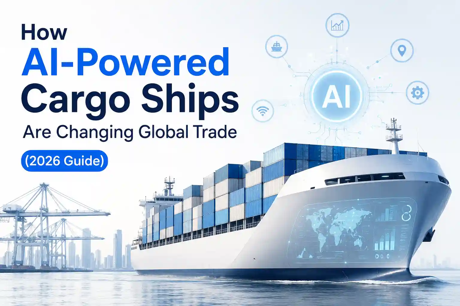
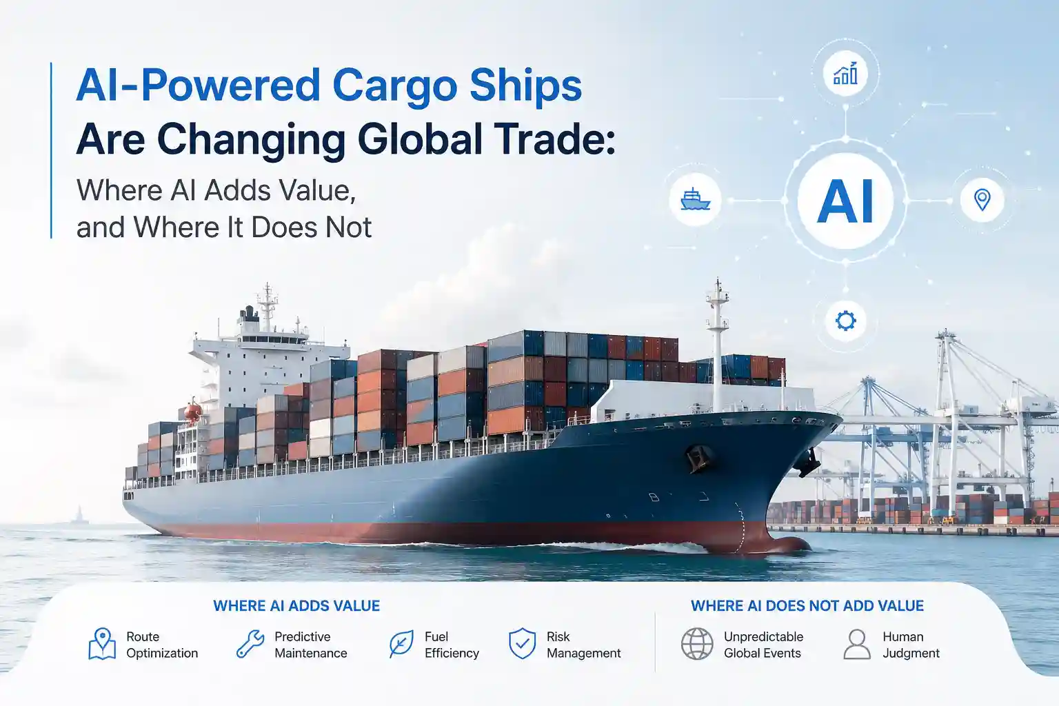
How AI-Powered Cargo Ships Are Changing Global Trade? What AI Routing Actually Looks Like in 2026 (Field Notes From the Bridge)
If you search for How AI-Powered Cargo Ships Are Changing Global Trade (2026 Guide), you will find conference slides, vendor whitepapers, and fleet management brochures promising automated decision-making and optimized bunker savings. You will not find the maintenance logs from the engine room, the bridge alarm silencing protocols, or the quiet reality that the algorithms still require human hands on the wheel when a squall line rolls over a confused sea state. The technology is real. The deployment is uneven. And the ocean does not respect predictive models.
Last November, I rode a 12,800 TEU container vessel across the North Atlantic on a routine westbound run. The ship carried a newly integrated voyage optimization suite: edge processors bolted to the navigation console, satellite-linked weather feeds feeding into machine-learning route predictors, and automated ballast adjustment scripts tied to trim and draft sensors. During harbor trials off Rotterdam, the dashboard drew clean, confident lines. Twelve days out, rolling through sea state 6 with intermittent Starlink handovers, the same interface started recommending course corrections based on wind vectors that no longer matched the actual swell pattern. The bridge team didn’t argue with the screen. They checked the local barograph, cross-referenced the physical radar overlay, and manually adjusted heading by four degrees. The portal continued publishing a green “On Optimization Track” status because the uplink hadn’t flushed the stale buffer.
That gap between the model and the water isn’t a software failure. It’s a deployment reality. AI-assisted cargo shipping doesn’t operate in a vacuum. It runs on vibrating steel hulls, through corroded cable glands, under shifting atmospheric pressure, and alongside crews who have learned to read the sea long before they had a dashboard to look at. What follows is not a summary of vendor claims. It’s a field-style breakdown of what happens when algorithmic routing meets actual maritime operations.
Hardware Behavior When the Sea Takes Over
Manufacturers publish operating temperature ranges and IP68 ratings based on controlled chamber testing. On a working vessel, those specifications meet continuous salt deposition, thermal cycling from engine room heat dissipation, and low-frequency vibration that travels through bulkhead mounting brackets. I’ve pulled telemetry junction boxes off ECDIS racks where the conformal coating remained intact, but the silicone around the M12 connector had micro-fractured from constant hull flexing. Moisture didn’t flood the board immediately. It condensed overnight during a cold front passage, bridged two adjacent traces, and introduced a persistent ground loop that threw off the ultrasonic draft sensors by eighteen millimeters.
The AI didn’t trigger a fault code. It just ingested skewed depth data, adjusted its fuel burn projection, and quietly drifted the recommended trim curve. The chief mate noticed the discrepancy during routine sounding checks. The fleet analyst three hundred miles away saw nothing but a smooth trendline.
Installation constraints rarely show up in procurement documents. You cannot run NMEA 2000 spurs parallel to high-voltage azimuth thruster lines without introducing electromagnetic interference that corrupts heading data. You cannot mount edge computing units near auxiliary boiler exhausts where ambient heat exceeds thermal throttling thresholds. You cannot place anemometer arrays on the mast behind radar scanner sweeps without capturing rotational turbulence that skews wind angle readings. Every mounting decision is a compromise between clean signal acquisition and available vessel geometry.
Crews adapt, but rarely in ways that align with installation manuals. I’ve seen sensor cables rerouted away from deck crane swing radii using marine tape and lashing rings because the factory clamps vibrated loose after six weeks. I’ve watched watchkeepers tape a strip of anti-fog film over the AI route optimizer display because salt mist from bridge wing ventilation consistently blurred the interface during heavy weather. These aren’t procedural violations. They’re practical workarounds for keeping digital systems functional in an environment that actively degrades them.
Salt exposure doesn’t announce itself with dramatic failure. It oxidizes unused diagnostic ports. It crystallizes along DIN rail contacts during dry spells. It bridges unshielded terminals when spray hits during gale-force crosswinds. Maintenance cycles that look manageable on a procurement spreadsheet compress rapidly when a vessel operates above Beaufort 7 for more than twenty percent of a transoceanic voyage. The processors keep running. They just require more physical intervention than the deployment guide anticipates.
Simulated Latency and Model Drift
I spent several weeks logging data from onboard edge units to observe how route prediction algorithms behave when satellite connectivity degrades. The setup wasn’t designed to stress-test hardware. It was meant to measure how quickly interpolated data becomes operationally misleading when the platform assumes continuous model sync.
During a simulated comms drop lasting eight minutes, the optimization suite began projecting fuel consumption based on historical wave resistance curves. The vessel was actually encountering a developing cross-swell that forced incremental rudder corrections every forty to sixty seconds. The dashboard smoothed the corrections into a steady heading. Dispatch received an ETA projection that assumed optimal hydrodynamic efficiency. The actual fuel burn ran 3.4 percent higher than predicted by the time the link stabilized and the model recalibrated.
The discrepancy didn’t come from broken sensors. It came from the algorithm filling missing packets with averaged assumptions. Predictive routing performs reliably when environmental conditions match historical training sets. It struggles when localized weather fronts, shifting current boundaries, and unmodeled hull biofouling introduce variables the system hasn’t weighted heavily enough to override baseline efficiency curves.
Dashboard friction compounds during port approaches. When multiple vessels share the same regional logistics workspace, alert suppression becomes a navigation necessity. I’ve observed bridge teams muting cargo stability warnings because the system fires every time a wave slap shifts a container stack’s weight distribution by a fraction of a percent. The software doesn’t malfunction. It just lacks the contextual filtering to distinguish between operational noise and genuine trim drift. Crews learn to read the underlying raw data instead of trusting the processed summary. It’s a slower workflow, but it prevents decision fatigue from masking actual stability concerns.
Who Actually Carries the Operational Weight
The operators who extract measurable value from AI-assisted routing aren’t reading implementation brochures. They’re the fleet planners who cross-reference bunker delivery logs with propeller pitch adjustments, then wash the data against historical weather routing archives to identify incremental savings. They understand that the AI isn’t an autopilot. It’s a secondary reference layer that supports planning when the environmental inputs remain clean.
Shipboard crews rarely treat these dashboards as primary decision tools unless the alert thresholds align with actual operational tolerances. If a stability warning triggers every time a ballast transfer creates a predictable list shift during loading, it gets silenced. Permanently. Implementation resistance rarely comes from stubborn officers. It comes from systems that demand more screen monitoring than the watch rotation allows, and more diagnostic follow-up than the maintenance budget covers.
Training isn’t a two-day vendor certification. It’s four to seven months of adjusting alert bands, observing which parameters actually drift under load, and accepting that a significant portion of algorithmic flags are false positives from sensor placement, not mechanical degradation. The learning curve isn’t steep, but it’s long. You need officers who understand the difference between a genuine hydrodynamic anomaly and an environmental artifact. You need engineers who can trace a corrupted data packet back to a fatigued coaxial connector or a misconfigured NMEA multiplexer.
Infrastructure requirements scale non-linearly. LEO satellite terminals require stable antenna alignment and clear sky visibility. Older VSAT installations on time-chartered vessels prioritize charterer voice traffic and email over telemetry packets, starving the AI dashboard during bandwidth contention. Cellular gateways work reliably within fifteen nautical miles of major shipping lanes, then degrade rapidly past headland shadowing or rain fade. Hybrid comms architectures solve coverage gaps, but they add configuration complexity, additional failure points, and a heavier troubleshooting burden for onboard technical staff.
The cost-to-practicality ratio rarely breaks even on bunker savings alone. The actual return comes from reduced schedule variance, earlier detection of gradual sensor drift, and better fleet-wide utilization metrics. Those benefits only materialize when the system integrates into existing maintenance workflows, not when it’s layered on top as a standalone efficiency tool.
Coastal Routing vs. Deep Ocean Behavior
Coastal operations compress the error margin but increase the interference. You’re within AIS range most of the day. Terrestrial cellular towers cover major estuaries. Weather models update frequently. The AI routing suite mostly sits idle, logging fuel burn, draft changes, and autopilot cycling. Software behaves predictably. Hardware stays behind the enclosed bridge glass. Maintenance intervals align with port calls.
Push past continental shelf boundaries or into open trade routes, and the monitoring paradigm shifts. Satellite latency stretches to 60-second intervals during constellation handovers. Swell and wind mask acoustic draft transducer readings. Pitch and roll introduce measurement noise that requires aggressive Kalman filtering. Older autopilot systems on mid-tonnage bulk carriers run on legacy control loops that choke when you try to push high-frequency environmental sensor arrays through unbuffered interfaces.
Automated routing works well when the hydrodynamic environment behaves predictably. Manual oversight becomes the primary plan when it doesn’t. I’ve tracked hybrid operations where the bridge watchkeeper keeps a paper log of trim adjustments during heavy weather because the automated trendline smooths out the spike caused by a forward ballast transfer. The system doesn’t malfunction. It just averages the data in a way that erases the immediate operational reality.
Commercial fleet systems handle this better than experimental testbeds, but only marginally. Commercial terminals include better error correction, redundant power inputs, and wider operating temperature tolerances. They still struggle with antenna misalignment during heavy rolling, and they still suffer from firmware updates that occasionally break legacy NMEA parsers. The difference is that commercial engineering teams know how to roll back a patch while the vessel is at anchor. Charter operators usually don’t.
Legacy infrastructure compounds these limitations. Vessels built before 2012 rarely have dedicated telemetry routing channels. You tap into existing engine monitoring lines, splice into bridge alarm circuits, and hope the signal isolation holds. It usually does, until thermal expansion shifts a ground plane and introduces voltage drift. You don’t catch the problem until the port survey data doesn’t match the onboard logs. By then, you’ve been running on skewed inputs for weeks.
Why the Algorithm Smooths Reality Instead of Reflecting It
Marine operational logic doesn’t translate cleanly into digital routing models. A cargo vessel isn’t a static data node. It’s a dynamic mass responding to hydrodynamics, thermal expansion, fuel stratification, and human intervention. When an AI system reports a sudden improvement in propulsive efficiency, the model looks for a validated optimization. The chief engineer knows the main engine was manually throttled back because a hydraulic crane was cycling under heavy load. The software lacks context. It reports what it calculates, not what it understands.
Infrastructure limitations amplify the gap. LEO constellations promise near-constant coverage, but antenna alignment on rolling decks introduces signal dropouts that aren’t logged as outages. They register as data gaps. The remote interface fills them with interpolated efficiency curves. The vessel was actually crabbing through a rip current. The dashboard draws an optimized heading.
Hardware degradation is rarely sudden. It’s cumulative. A corroded ground plane, a fatigued coaxial connector, a fouled flow sensor, a stretched tension cable on a trim transducer. Each one degrades the signal-to-noise ratio just enough that the routing engine starts averaging instead of reflecting. Operators adapt by layering manual checks, but redundancy adds weight, increases installation complexity, and introduces another set of maintenance intervals that compress during heavy weather.
Communication reliability fluctuates with atmospheric conditions. Solar flare activity disrupts ionospheric propagation. Heavy precipitation attenuates Ku-band and Ka-band signals. High sea states scatter antenna lobes and increase phase noise. The AI doesn’t fail during these conditions. It just operates at reduced fidelity, publishing what it can capture while the rest sits buffered until the next uplink window clears.
Human workflow adaptation is the only thing that bridges the divide. Crews learn to read the routing dashboard with healthy skepticism. They verify critical efficiency flags with physical engine checks. They ignore routine fluctuations that fall within normal operational bands. They log discrepancies manually when the software smooths out reality. It’s inefficient on paper. It’s necessary at sea.
Recent maritime engineering studies from coastal research labs align with these observations. Deployment analyses consistently note that automated anomaly detection works best when calibrated to specific hull forms, propeller configurations, and operational profiles. Generic thresholds generate false positives at unsustainable rates. The ocean introduces acoustic and hydrodynamic noise that controlled basin testing rarely captures. NOAA current modeling datasets and university marine lab hydrodynamic simulations confirm how environmental variables distort sensor readings when telemetry gates don’t filter for wave-induced pitch, roll, and yaw.
Documented Friction Points That Break Deployments
The friction accumulates in the cable trays and on the bridge console. It’s rarely dramatic. It’s persistent.
Salt creep along unsealed DIN rail connections causes phantom voltage readings that trigger low-power warnings. Cable runs routed near auxiliary exhaust manifolds soften over fourteen months, requiring replacement during scheduled dry-dock windows. Dashboard clutter becomes a genuine navigation issue when every subsystem publishes to the same remote interface. You scroll past ballast pump temperatures, cargo lashing tension readings, and scrubber pressure differentials to find the one parameter that actually matters during a squall passage.
Software patches push through during port stays, but firmware updates occasionally break legacy NMEA 0183 multiplexers, forcing the technical superintendent to roll back while the vessel is at berth. Sensor degradation on ultrasonic draft markers shows up as gradual measurement drift that only gets caught during port survey calibration. The learning curve isn’t sharp, but it’s long. Officers spend more time troubleshooting false efficiency alerts than they do responding to genuine propulsion faults.
Corrosion doesn’t respect warranty periods. It exploits every unsealed interface, every poorly routed cable tie, every mounting bracket that vibrates against painted steel. Maintenance burden scales exponentially once you exceed the manufacturer’s recommended environmental envelope. Inconsistent tracking emerges when satellite handovers coincide with heavy swell masking antenna radiation patterns. Weather interference isn’t an edge case. It’s the baseline operating condition.
Unreliable updates compound dashboard frustration. When the system refreshes every forty seconds during clear-sky satellite lock, then drops to ninety-second intervals offshore, the remote interface starts displaying stale route data that conflicts with the physical ECDIS overlay. Officers adapt by trusting local instruments over digital portals. It’s a rational compromise, but it undermines the original deployment objective.
Installation delays rarely stem from missing hardware. They come from vessel geometry constraints, existing wiring congestion, and the reality that retrofitting an AI routing layer onto an active cargo vessel means interrupting normal operations for days while technicians route fiber, test signal isolation, and calibrate sensor baselines. You cannot simply connect it and walk away. You have to integrate it into a bridge ecosystem that already operates at full capacity.
The Practical Compromise at Sea
AI-assisted cargo routing works when it’s treated as a planning reference, not a command system. Officers who survive deployment friction don’t chase perfect data streams. They build tolerance for latency, cross-reference efficiency flags with physical engine logs, and accept that some parameters will drift until port maintenance can address them. The platforms are useful. They are not autonomous.
You still need someone on the bridge who knows the difference between a sensor glitch and a real trim problem. Someone willing to wipe condensation off a terminal screen, trace a corrupted NMEA sentence back to a loose ground lug, and understand that open-ocean conditions rarely match the calibration spreadsheet. You need fleet managers who recognize that digital routing reduces guesswork, but doesn’t eliminate the need for experienced hydrodynamic judgment.
The technology doesn’t replace seamanship. It extends it. It gives planners more historical data to work with, but it also gives them more ways to misinterpret what they’re seeing if they don’t understand the physical environment generating the measurements. The most successful fleet deployments aren’t the ones with the smoothest dashboards. They’re the ones where bridge teams know exactly what the system cannot see, and they compensate without hesitation.
Global trade shifts incrementally, not through sudden automation breakthroughs. Bunker consumption drops by fractions of a percent when routing algorithms align with actual sea states rather than historical averages. Schedule reliability improves when dispatchers stop treating AI projections as guarantees and start using them as one layer among many. Environmental compliance becomes manageable when officers understand how trim optimization interacts with actual cargo weight distribution.
The ocean remains indifferent to algorithmic confidence. The vessels that perform consistently in 2026 aren’t the ones with the most advanced AI suites. They’re the ones where crews treat digital routing as a tool to verify intuition, not replace it. Where maintenance budgets account for saltwater degradation, not just software licenses. Where fleet operators accept that efficiency gains come from human-system collaboration, not full automation.
That’s the actual baseline. Not seamless optimization. Not autonomous cargo movement. Just better data for people who already know how to move ships through uncertain water.